Forest Ravines and Moraine Ridges of Gdańsk: MTB in the Heart of the Tricity Landscape Park
✨ Key Route Information (Quick Facts)
GPX Route for Garmin, Wahoo, Komoot, and Other Bike Computers
Download the free GPX track of this cycling route. The file can be used on Garmin Edge, Wahoo ELEMNT, Hammerhead Karoo, Bryton Rider bike computers and Komoot, OsmAnd, or Ride with GPS apps.
- 1. Moraine Ridges and Forest Ravines of Gdańsk: MTB in the Tricity Landscape Park
- 2. Route at a Glance
- 3. Gateway to the Woodlands: Opening Kilometres into the Moraine
- 4. Moraine Bastions and Hidden History: Climbing into the Park's Core
- 5. Summiting at 127 m a.s.l.: Catching Breath Above the Canopy
- 6. The Gravity Rush and Return via Forest Byways
- 7. Trailside Highlights: What to See Along the Route
- 8. Practical Trail Guide: Coffee Stops, Hydration & Setup
▶ Route Video & YouTube Vlog
Nakręcone Rowerem — YouTube
YouTube HD@nakrecone-rowerem • Cycling, Gravel & Mountains
Dynamiczny zjazd MTB w Gdańsku! | Czy Trek Procaliber 9.5 daje radę?
Interactive GPS Map
Precise GPX track route with waypoints
Terrain & Surface Breakdown
Surface details, terrain breakdown, and gear tips
🏆 Route Highlights & Scenic Spots:
- ✓ Samborowo Valley and glacial moraine erosion ravines
- ✓ Moraine summit at 127 m above sea level with lush canopy panoramas
- ✓ Crux forest climb maxing out at a brutal 28% gradient
- ✓ Flowing, over-a-kilometre downhill charge towards the woodland edge
🛣️ Terrain & Surface Breakdown
Mostly forest roads, compacted dirt doubletracks, and gravel paths paired with natural singletrack sections laced with roots. Dynamic moraine elevation profile featuring short, punchy crux climbs and fast descents.
🚴 Recommended Bike & Gear
An MTB hardtail or short-travel full suspension bike equipped with minimum 2.20-inch knobby tyres for confident grip on wet humus and slick roots. A dropper post is highly advantageous on steep drop-offs.
📍 Location — Poland
Gdańsk, Pomerania, Poland (PL) — 23.6 km, +345m.
Moraine Ridges and Forest Ravines of Gdańsk: MTB in the Tricity Landscape Park
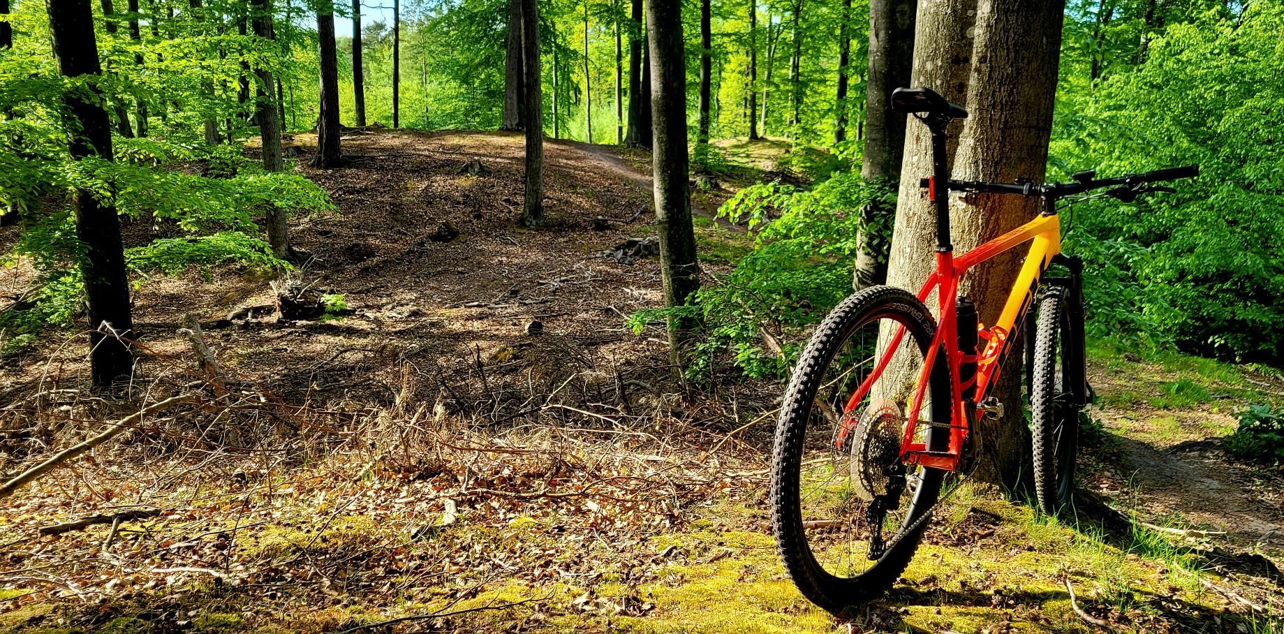
The morning air in Gdańsk's woods carries the sharp aroma of damp moss, turned earth, and decaying beech leaves. Just a few hundred metres beyond the dense suburban perimeter, you cross into an entirely separate realm—a landscape of sculpted erosion ravines, imposing glacial moraines, and wild woodlands that have guarded the interior of the Tricity Landscape Park for centuries. Viewed from the saddle of a mountain bike, Gdańsk reveals an astonishingly mountainous, rugged, and magnetic character. This loop of roughly 24 kilometres captures the very best of northern Poland's coastal uplands: from rustling singletracks under old-growth canopies to rapid descents plunging down glacial valleys.
| Parameter | Metric |
| Distance | 23.6 km |
| Elevation | +345 m |
| Moving Time | ~1h 23m |
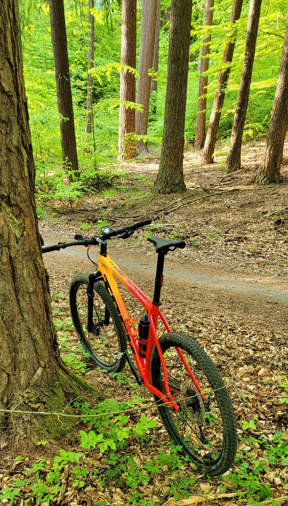
| Bike on the Route | Trek Procaliber 9.5 (XC Hardtail) |
| Highest Elevation | +345 m |
| Crux Climb | 0.4 km (+61 m, max 28%) |
| Trail Profile | Sporting cross-country / Forest paths, doubletrack & gravel |
Gateway to the Woodlands: Opening Kilometres into the Moraine
Our ride begins at the outer boundary of Gdańsk's residential quarters, where traffic hum vanishes instantly into a dense timber curtain. The initial pedal strokes launch you onto hardpack gravel roads climbing steadily into the woodland reserve. Morning light filters through towering oaks and Scots pines, dapple-patterning the track ahead. The Trek Procaliber 9.5 settles immediately into its cross-country stride—the lightweight carbon frame with its IsoSpeed decoupler filters high-frequency chatter and shallow roots, maintaining rolling momentum without sapping wattage.
Soon, the forestry road tapers into narrow tracks meandering over natural contours. The Tricity Landscape Park takes no prisoners: sculpted by the Scandinavian ice sheet during the Pleistocene epoch, the terrain features steep gullies and tight ridges that demand active body language over the bars. Deeper into the woods, quiet clearings emerge where low-lying mist dissolves under the autumn sun. The air remains crisp, with fine gravel and wet loam crackling beneath wide knobby tyres.
Following a brief warm-up, the cadence locks into a rhythmic flow. The path rolls through dynamic switchbacks around fallen timber and scattered glacial erratics. Here, you truly comprehend Gdańsk's unique setting—a Baltic port city directly kissing a rugged northern mountain enclave. With every crank revolution, civilised life recedes further behind dense woodland.
Moraine Bastions and Hidden History: Climbing into the Park's Core
Approaching the ten-kilometre mark, the trail profile ramps up dramatically. We enter the crux sector that puts cadence, leg power, and tyre adhesion to an uncompromising test. The path swerves abruptly upward, with gradients spiking violently toward 28%. Tyres claw into forest humus, hunting for purchase over slick roots and damp silt. Every metre demands total concentration, low chest position, and nuanced weight distribution to prevent the front wheel from wandering off line. Gaining more than 60 metres of vertical ascent within a mere 400 metres provides a fierce adrenaline rush and indisputable proof of this region's glacial muscle.
Cathedral-like stands of ancient European beech flank the trail, their sprawling root networks forming natural staircases down the slopes. Beyond geological drama, these woodlands hide traces of Baltic history—sunken carriage roads, historic triangulation markers dating back to the Free City of Danzig, and quiet woodland gravesites. Riding the narrow crests above gaping ravines invites you to ease off the throttle and admire how time slows beneath this canopy.
Once over the steepest moraine ramp, the path levels out into a flowing forest ribbon. The bike tracking remains utterly composed, allowing heart rates to settle before the next rolling challenge. Woodpecker drumming resonates high in the beech branches as small birds rustle through the underbrush, creating a tranquil counterweight to the intense climbing effort just conquered.
Around kilometre 18, the climb tops out onto the highest elevation of the loop: a commanding moraine spine sitting 127 metres above sea level. In close proximity to the Baltic coast, this elevation feels remarkably substantial, especially when glancing down the near-vertical flanks dropping into shadowy hollows. It is the perfect opportunity to pause in the saddle, reach for an isotonic drink, and take in the cool maritime breeze.
Through gaps in the tree canopy, rolling green crests unfold endlessly towards the horizon; on crisp, cloudless days, the distant blue sheen of the Bay of Gdańsk twinkles in the backdrop. An encompassing silence blankets the ridge, broken only by the rustle of leaves overhead. It serves as an impressive reminder that mountain biking does not require alpine altitude to deliver majestic wilderness and raw physical rewards.
This high point marks the ride's key turning point. Ahead lies what every mountain biker seeks: an extended, fast descent shedding over 80 vertical metres. The progressive cross-country geometry inspires immediate confidence, encouraging you to ease off the disc brakes and sink into pure downhill flow.
The Gravity Rush and Return via Forest Byways
The descent off the summit ridge down to the valley floor is pure XC bliss. The singletrack plunges fast, banking through natural contours bordered by lush ferns and moss-draped fallen logs. Speed builds effortlessly on the computer, with wide rubber gripping firmly across banked forest dirt and loose gravel compressions. Navigating through successive curves highlights the micro-topography—abrupt dips, weathered root drop-offs, and gully g-outs that spark genuine grin-inducing thrill.
Over a continuous kilometre of descending lets you tap into the raw flow of Pomeranian singletrack. Wind howls through the helmet vents while the air warms slightly towards the floor of the ravine. Once through the technical downhill segment, the gradient eases into wide, peaceful fire roads where the afternoon sun casts elongated shadows across sandy gravel.
The final stretch is a soothing spin back to our starting point. Hard-worked quads blend with the deep satisfaction of conquering 24 demanding moraine kilometres in swift time. The wild forest gives way to urban borders, leaving the rugged moraine wilderness behind—waiting for the next lap.
Trailside Highlights: What to See Along the Route
- ↳ Samborowo Valley: One of the most picturesque erosion gorges in the Tricity Landscape Park. Bounded by dramatic slopes with an almost submontane feel, it preserves monumental pedunculate oaks and scots pines. Ease your pace here to absorb the valley's distinct acoustics and cool microclimate.
- ↳ Borkowski's Boulder (Głaz Borkowskiego): A mammoth granite glacial erratic resting on a moraine hillside, ferried south from Scandinavia by ancient glaciers. It forms a striking landmark and a testament to the ice age forces that forged northern Poland.
- ↳ Moraine Ridges & Coastal Panoramas: Natural elevated lookouts exceeding 120 metres elevation, where lucky riders on crystal-clear days can catch glimpses of the Bay of Gdańsk through beech tree crowns.
Practical Trail Guide: Coffee Stops, Hydration & Setup
- ↳ Coffee Stops & Local Flavours: This loop was tackled in continuous sporting fashion, relying entirely on jersey-pocket nutrition (energy bars, gels, and electrolytes). For recreational touring, treat yourself after the ride in the historic districts of Gdańsk Oliwa or Strzyża, both famous for excellent specialty coffee roasters and fresh Polish pastries.
- ↳ Water & Rest Areas: No commercial water outlets exist within the deep forest trails; pack at least 1.0 to 1.5 litres in bottles or a hydration pack. Several wooden shelters and benches maintained by the State Forests provide welcome rest spots along the trail.
- ↳ Recommended Bike & Tyres: A lightweight hardtail or fast 100–120 mm full-suspension bike is the weapon of choice. Fit 2.20" to 2.35" tubeless tyres with versatile XC tread patterns to master punchy 28% pinches and secure fast traction over damp roots.
- ↳ Navigation & GPX: The dense network of tracks in the Tricity Landscape Park can disorient even seasoned locals. Load the GPX route onto your GPS head unit or smartwatch to stay on track effortlessly.
Frequently Asked Questions (FAQ)
Everything you need to know before hitting this route
How long does this MTB route take to complete?
▾
What are the primary natural highlights along this trail?
▾
Which type of bike is best suited for this loop?
▾
Free Bike Coloring Pages A4 for Kids & Family
65 vector coloring sheets ready to print (300 DPI, no login required). Gravel, Full MTB, E-Bike & XC!