Gdańsk Moraines and Kashubian Forest Tracks: A 50-km Gravel Loop Overlooking the Bay
✨ Key Route Information (Quick Facts)
GPX Route for Garmin, Wahoo, Komoot, and Other Bike Computers
Download the free GPX track of this cycling route. The file can be used on Garmin Edge, Wahoo ELEMNT, Hammerhead Karoo, Bryton Rider bike computers and Komoot, OsmAnd, or Ride with GPS apps.
- 1. Gdańsk Moraines and Kashubian Forest Tracks: A 50-km Gravel Loop
- 2. Route & Gear Profile
- 3. Heading into Forest Solitude: The Roll-out and Otomino Tracks
- 4. Tracing the Gralaths: Kashubian Borderlands
- 5. Summit Push: The 157 m Panoramic Crest
- 6. The Moraine Descent: Rolling Home to Gdańsk
- 7. Sightseeing Highlights Along the Loop
- 8. Practical Guide: Coffee, Hydration & Tips
▶ Route Video & YouTube Vlog
Nakręcone Rowerem — YouTube
YouTube HD@nakrecone-rowerem • Cycling, Gravel & Mountains
Przejechałem całe Trójmiasto lasami! | Epicki Gravel z Gdańska do Osowej 🌲
Interactive GPS Map
Precise GPX track route with waypoints
Terrain & Surface Breakdown
Surface details, terrain breakdown, and gear tips
🏆 Route Highlights & Scenic Spots:
- ✓ Picturesque forest tracks of the Otomino Forests and the Lake Otomińskie area
- ✓ Historic chapel and cemetery of the Gralath family in Sulmin
- ✓ Open panoramic views over the Gdańsk Upland overlooking moraine ridges
- ✓ Fast, twisting descents through Tricity forest corridors
🛣️ Terrain & Surface Breakdown
Well-balanced gravel route: hard-packed forest tracks, varied gravel sizes, short quiet asphalt links, and rural dirt roads. Glacial moraine terrain featuring short, steep climbs ramping up to 20%.
🚴 Recommended Bike & Gear
Gravel bike fitted with at least 38-40 mm tyres with defined shoulder knobs for loose gravel and forest litter. Micro-suspension systems help tame braking bumps and root carpets.
📍 Location — Poland
Gdańsk, Pomerania, Poland (PL) — 50.1 km, +436m.
Gdańsk Moraines and Kashubian Forest Tracks: A 50-km Gravel Loop
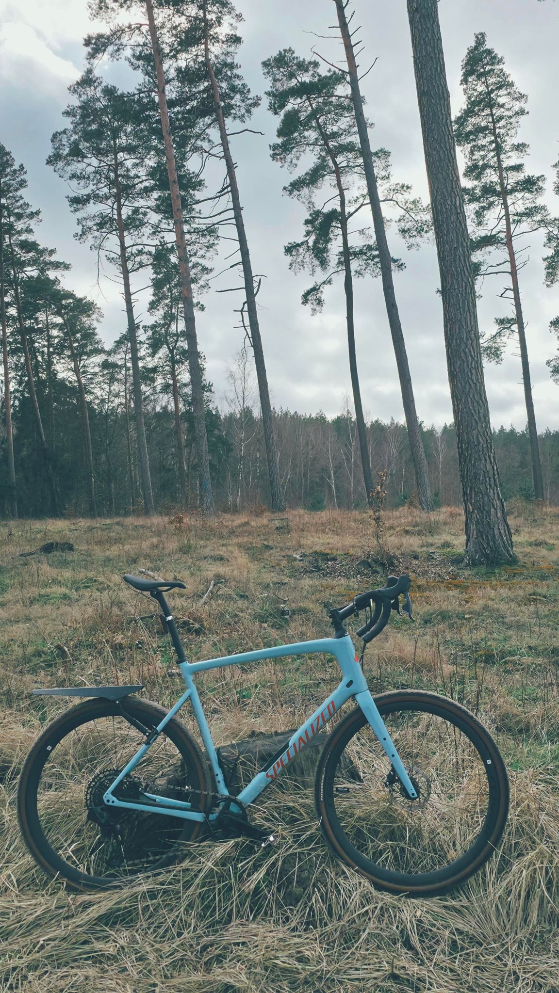
The air over the Gdańsk moraine hills carried that distinct maritime chill foretelling an afternoon weather shift. Just a fifteen-minute spin away from the dense metropolitan blocks, city clamour gave way to the muted crunch of last season's leaves and the rich scent of ancient beech woods. Today's route is a textbook showcase of what the Gdańsk Upland offers best: technical moraine undulations, dense pine-beech stands, and fast-rolling gravel sectors opening into rural Kashubian plains. Ahead lies just over fifty kilometres of undulating terrain and our ever-present coastal companion—gusty Baltic winds.
| Parameter | Data |
| Distance | 50.1 km |
| Elevation | +436 m |
| Net Riding Time | 2h 38min |
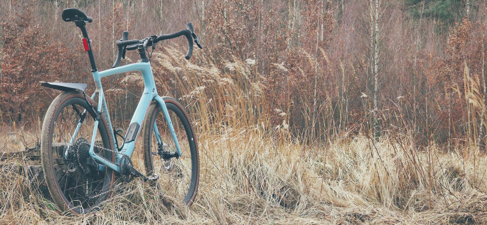
| Bike | Specialized Diverge Expert Carbon (2022) |
| Highest Elevation | +436 m |
| Crux Climb | 0.6 km (+53m, max 20%) |
| Terrain Character | Scenic gravel outing / Fast gravel & quiet backroads |
Heading into Forest Solitude: The Roll-out and Otomino Tracks
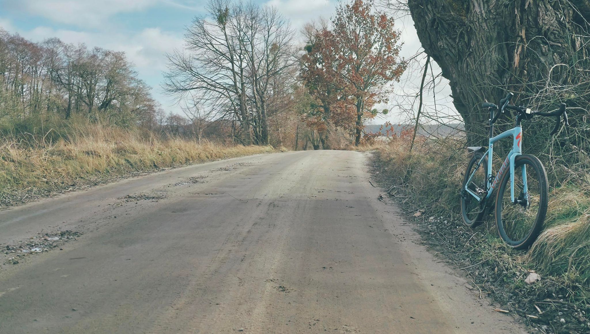
Rolling out from the outer districts of Gdańsk, the route immediately darts into green space. Tarmac quickly yields to firmly packed forest tracks. The opening kilometres climb gently along sweeping curves towards Kolbudy and the Otomino Forests. A lush tree canopy filters out the sea breeze. The Specialized Diverge Expert Carbon surges smoothly over damp loam, its Pirelli Cinturato Gravel M 700x40c tyres biting with authority into fine gravel and forest bed.
These first ten kilometres deliver pure gravel flow. The trail weaves through deep ravines carved by the receding ice sheet millennia ago. At kilometer ten, I pause briefly at Fire Road access point No. 6 near Otomino. A three-minute pit stop allows a quick tyre pressure check, a sip of electrolytes, and a moment to savour the absolute silence—punctuated only by a woodpecker drumming on an oak trunk and wind whispering through pine needles.
With every kilometre, the track ripples into steeper rollers. Short, punchy kickers keep cadence dynamic, while the carbon Roval Terra C wheelset snaps back instantly on each out-of-the-saddle effort. The Future Shock 2.0 system in the headtube absorbs harsh root strikes, saving forearms and shoulders for the second half of the loop.
Tracing the Gralaths: Kashubian Borderlands
Leaving the dense Otomino stands behind, the route heads west towards Sulmin—a captivating spot on the regional map. Past kilometer thirteen at Orłana, we soon reach Gralath Street. Sulmin once belonged to the prominent Gdańsk patrician family of Gralath—ancestral home to Daniel Gralath, the 18th-century scholar, Gdańsk mayor, and pioneer of electrical experiments. A brief stop lets me absorb the historical atmosphere where Kashubian countryside meets noble heritage; tucked in the woods nearby lie the traces of their ancestral burial ground.
Here the landscape opens wide. Endless meadows and rolling crop fields replace the solid timber walls. Out in the open, the day's true challenger hits: a stiff, gusting westerly crosswind that tests momentum and discipline. Dropping low onto the flared drops, the Diverge's settled geometry shines. Despite the drag, wide-open horizons reveal the rhythmic contours of the ground moraine.
Quiet farm roads and narrow asphalt link roads guide me towards Rębiechowo. At the rest point on Akacjowa Street (km 29.2), I take another brief breather. This is where Pomeranian connectivity brushes shoulders with rural calm: a passenger jet climbs away from nearby Gdańsk Airport, yet among roadside willows, time ticks at its own relaxed cadence.
Summit Push: The 157 m Panoramic Crest
The northern arc of the loop swings back toward the metropolitan border. With forty kilometres in the legs, the cumulative climbing and wind drag begin to register, but the profile holds one steep card in reserve. Passing the 43rd kilometre, the ascent begins towards the highest elevation of the day: 157 m a.s.l.
The climax of this moraine climb arrives between km 47 and 49: a 600-metre ramp gaining 53 vertical metres, with the gradient pitching up to a biting 20%. Gear choices matter here; spinning a disciplined cadence while staying seated guarantees the rear tyre claws into the loose gravel crest without spinning out.
The payoff is a sweeping panorama over the eastern districts of Gdańsk, with the silvery sheen of the Baltic Sea's Gdańsk Bay visible on clear days. A technical descent follows, dropping through fast, twisting woodland trails where momentum easily carries speeds up to 47 km/h.
The Moraine Descent: Rolling Home to Gdańsk
The final stretch leads toward Franciszek Rakoczy Street in Gdańsk (km 49.5), where an urban rest stop provides a moment to spin down before returning to base. The loop clocks out at 50.1 kilometres. It is a ride defined by sharp contrasts: the silent forest ravines of Otomino, the heritage of Sulmin, and the wind-swept ridges of the Baltic moraine.
Sightseeing Highlights Along the Loop
- Otomino Forests & Lake Otomińskie: A picturesque forest complex with grand veteran trees. A short detour south leads straight to the serene, wooded shoreline of Lake Otomińskie.
- Sulmin & Gralath Heritage: A historic Kashubian village featuring ancient manor grounds and the secluded woodland cemetery of the prominent Gralath family.
- Moraine Ridges & Strzyża Valley Lookouts: The high ridges offer natural vantage points toward the city of Gdańsk and distant ship traffic in the outer harbour.
Practical Guide: Coffee, Hydration & Tips
- Coffee Stops & Local Flavours: The timber rest stop at Fire Road No. 6 near Otomino is ideal for energy bars and trail snacks. Sulmin also offers shady spots under mature trees.
- Water & Resupply: Convenience stores in Sulmin or Rębiechowo are convenient for refilling bottles and picking up fuel.
- Recommended Bike & Tyres: A dedicated gravel bike or lightweight hardtail MTB is ideal. Opt for 40-45 mm tubeless tyres with versatile tread to tackle gradients up to 20% on loose surfaces.
- Navigation: The forest maze features numerous unmarked logging forks; load the GPX track to your bike computer for uninterrupted flow.
Frequently Asked Questions (FAQ)
Everything you need to know before hitting this route
How long does this gravel route take?
▾
What are the key sights along the route?
▾
What bike and tyres work best here?
▾
Free Bike Coloring Pages A4 for Kids & Family
65 vector coloring sheets ready to print (300 DPI, no login required). Gravel, Full MTB, E-Bike & XC!