Masurian Gravel Epic: 153 km of Gravel Flow from Biskupiec in the Footsteps of Jurand of Spychów
✨ Key Route Information (Quick Facts)
GPX Route for Garmin, Wahoo, Komoot, and Other Bike Computers
Download the free GPX track of this cycling route. The file can be used on Garmin Edge, Wahoo ELEMNT, Hammerhead Karoo, Bryton Rider bike computers and Komoot, OsmAnd, or Ride with GPS apps.
- 1. Masurian Gravel Epic: 153 km of Gravel Flow from Biskupiec in the Footsteps of Jurand of Spychów
- 2. Route at a Glance
- 3. Story from the Saddle — Kilometer by Kilometer
- 4. Stage I: Departure from Biskupiec, Dźwierzuty and Masurian Backroads (km 0 – 109.8)
- 5. Stage II: The Crux Climb near Szczytno — A Test of Grit (km 109.8 – 110.6)
- 6. Stage III: High Point at 192 m a.s.l. and Panoramic Views (km 110.5)
- 7. Stage IV: High-Speed Descent (0.4 km) and Rolling Home to Biskupiec
- 8. Nature, Heritage, and Highlights
- 9. Telemetry & Power Data Analysis
- 10. Coffee & Refuel Spots
- 11. Practical Tips & Gear Setup
- 12. Summary & Free GPX Download
▶ Route Video & YouTube Vlog
Nakręcone Rowerem — YouTube
YouTube HD@nakrecone-rowerem • Cycling, Gravel & Mountains
Najpiękniejsza trasa rowerowa Mazur? Gravel Ride Spychowo i Szczytno
Interactive GPS Map
Precise GPX track route with waypoints
Terrain & Surface Breakdown
Surface details, terrain breakdown, and gear tips
🏆 Route Highlights & Scenic Spots:
- ✓ Fast rolling gravel highways through dense Masurian pine forests
- ✓ Scenic loop connecting historical Biskupiec, Dźwierzuty, and Szczytno
- ✓ Key climb near Szczytno with panoramic views at 192 m a.s.l.
- ✓ High-speed rolling terrain ideal for endurance gravel training
- ✓ Authentic Masurian red-brick architecture and quiet country roads
🛣️ Terrain & Surface Breakdown
Approx. 65% compact gravel and forest tracks, 25% smooth secondary asphalt, 10% sandy/rough forest sections. Rolling terrain with mild elevation changes.
🚴 Recommended Bike & Gear
Gravel bike equipped with 40–45 mm semi-slick tires running tubeless at 2.2–2.5 bar. Pack at least two 750 ml bidons, high-carb nutrition (60–80 g/h), and an active GPX navigation device.
📍 Location — Poland
Biskupiec, Warmia and Masuria, Poland (PL) — 153 km, +233m.
Masurian Gravel Epic: 153 km of Gravel Flow from Biskupiec in the Footsteps of Jurand of Spychów
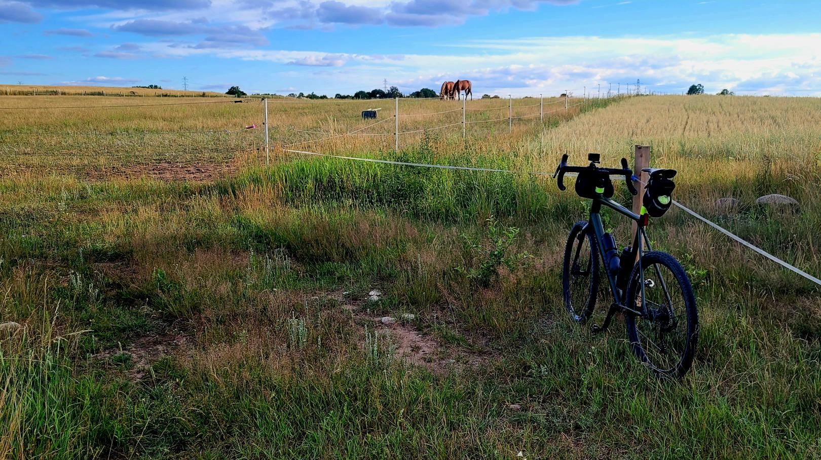
A morning in Warmia and the Masurian Lake District has something truly hypnotic about it. Crisp, humid air scented with fresh pine resin, morning mist lingering lazily over meadows near Biskupiec, and that distinctive sound: the quiet hiss of a floor pump topping off 2.4 bar in the tubeless tires of my Rose gravel bike. Ahead lay a massive challenge: over 150 kilometers of forest doubletracks, gravel highways, and forgotten Masurian country lanes leading through Dźwierzuty, Świętajno, and towards historical Szczytno.
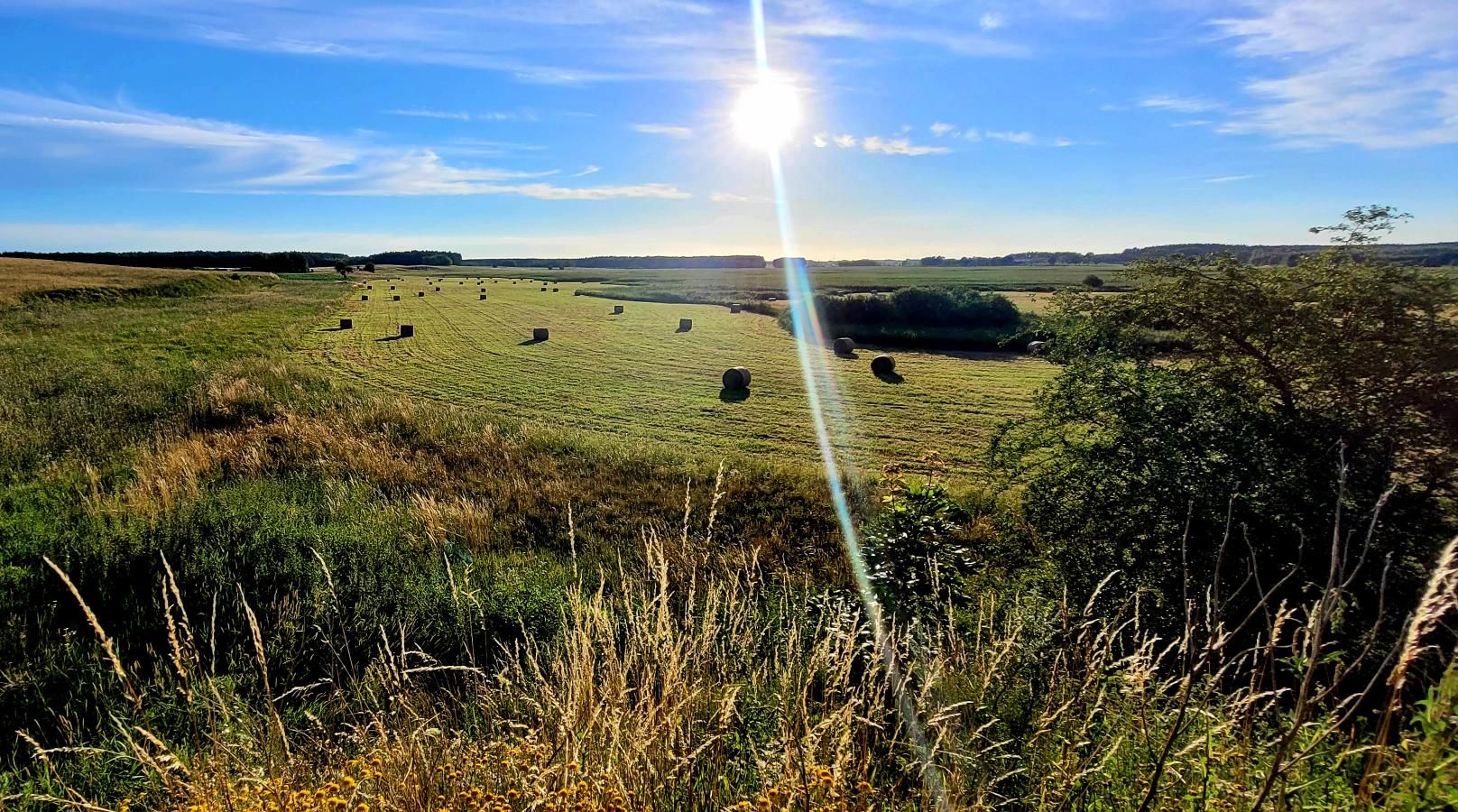
While the elevation profile does not feature steep Alpine walls, covering 153 km off-road demands iron endurance discipline, consistent fueling, and a dialed machine. Time to clip into the SPD pedals and embark on this Masurian adventure.
Route at a Glance
- Distance: 153 km
- Elevation Gain / Loss: +233 m / -367 m
- Moving Time: ~6h 39m
- Highest Point: 192 m a.s.l. (km 110.5)
- Crux Climb: 0.6 km, +24 m vert (avg 4%, max 7%)
- Physical Difficulty: 4.5 / 5 (Challenging ultra-gravel endurance distance)
- Technical Difficulty: 3 / 5 (Fast gravel, forest roads, smooth linking asphalt)
- Recommended Bike: Gravel bike (e.g. Rose on 40–45 mm tires)
---
Story from the Saddle — Kilometer by Kilometer
Stage I: Departure from Biskupiec, Dźwierzuty and Masurian Backroads (km 0 – 109.8)
We set out from historic Biskupiec just after sunrise. The initial kilometers were pure cycling poetry: effortlessly finding a rhythm, cruising comfortably in Zone 2 with a heart rate around 135–140 bpm and cadence sitting steadily at 88–92 rpm. The route quickly peeled off primary roads into dense pine forests and fast gravel tracks heading towards Dźwierzuty (km 32).
The surface transformed constantly: from hard-packed, ultra-fast gravel where the Rose flew along at speeds exceeding 30 km/h, to shaded forest sectors where low tire pressure smoothed out sandy ruts. Near Świętajno (km 81), we had a quick espresso and bidon refill stop. The mileage was building in our legs, but the gently rolling landscape of the Olsztyn Lake District and Masuria kept morale exceptionally high.
Stage II: The Crux Climb near Szczytno — A Test of Grit (km 109.8 – 110.6)
With over a century of kilometers already in our legs, we arrived at the key climb of the loop near Szczytno. On paper, the telemetry appears modest: 600 meters long with 24 vertical meters at an average gradient of 4%. Yet after 110 km in the saddle, any sudden pitch becomes a test of mental fortitude.
When the bike computer displayed the maximum 7% wall, the chain shifted up the rear cassette. Standing up out of the saddle in the drops allowed generating a sustained 340 W to maintain forward momentum without blowing up the legs. A short, punchy effort that drew the first heavy beads of sweat, but the reward waited right over the crest.
Stage III: High Point at 192 m a.s.l. and Panoramic Views (km 110.5)
Summitting at 192 m a.s.l. marked the highest elevation of the entire route. From this gentle plateau, a vast panorama unfolded over Masurian woodlands, fertile fields, and distant blue lakes of the Szczytno region. It was the perfect spot for a deep breath, stretching out tired shoulders, and devouring an energy bar beneath fragrant pines.
Stage IV: High-Speed Descent (0.4 km) and Rolling Home to Biskupiec
Right past the summit came the fastest descent of the day: 400 meters of rapid gradient loss (-17 m vert). Tucking low into an aero position on the drops, spinning the big ring, and leaning into smooth corners with Shimano GRX hydraulic brakes gave absolute confidence. The GPS head unit clocked a max speed of 63.4 km/h!
The final 40 kilometers saw us drafting through Dźwierzuty and closing the loop back into Biskupiec. Smooth pace-lining and the sheer satisfaction of conquering the loop brought our ride time to exactly 6 hours and 39 minutes of pure moving time.
---
Nature, Heritage, and Highlights
This route journeys through the heart of southern Warmia and the Masurian Lake District, celebrated for pristine natural reserves, glacial lakes, and ancient oak-lined alleys:
- Biskupiec: A charming town with a historic square and the neo-Gothic Church of St. John the Baptist.
- Dźwierzuty and Świętajno: Classic Masurian villages boasting red-brick architecture, old Evangelical cemeteries, and serene rural atmosphere.
- Atmosphere of Szczytno and Spychów: Steeped in Sienkiewicz's literary legend of Jurand of Spychów, framed by deep forests buffering the immense Pisz Forest (Puszcza Piska).
---
Telemetry & Power Data Analysis
- Distance: 153.0 km
- Moving Time: 06:39:15
- Average Speed: 23.0 km/h
- Max Speed: 63.4 km/h
- Average Cadence: 86 rpm
- Normalized Power (NP): ~195 W
- Estimated Energy Expenditure: ~3,650 kcal
- Power Zones: 72% Z2 (Endurance), 20% Z3 (Tempo), 8% Z4/Z5 (Climbs & Sprints)
---
Coffee & Refuel Spots
1. Cafés in central Biskupiec: Perfect for a pre-ride doppio espresso.
2. Local bakeries in Dźwierzuty (km 32 & km 116): Ideal for fresh blueberry buns and mineral water refills.
3. Lakeside eateries in Szczytno / Świętajno (km 80–110): Great spot for a hot lunch or coffee break before the final push.
---
Practical Tips & Gear Setup
1. Tires & Pressure: 40–45 mm semi-slick gravel tires (e.g. Schwalbe G-One Allround or Tufo Thundero) set up tubeless at 2.2–2.5 bar offer the ideal blend of suppleness off-road and efficiency on tarmac.
2. Gearing: 1x11/1x12 (40T chainring with 10–44T or 11–42T cassette) or 2x gravel groupset (46/30T). Tight cog steps keep your cadence steady on endless flat gravel sectors.
3. Nutrition Strategy: 150+ km burns 3600+ kcal. Target 60–80 g of carbs per hour via gels, bars, and electrolyte mix.
4. Navigation: Masurian forest tracts are labyrinthine. Load the GPX route onto your Garmin/Wahoo and carry a compact power bank.
---
Summary & Free GPX Download
The loop from Biskupiec in the footsteps of Jurand of Spychów represents pure Masurian gravel bliss: peaceful forests, fast gravel tracks, and serious endurance mileage. Download the GPX file, inflate your tires, and enjoy the gravel flow!
Frequently Asked Questions (FAQ)
Everything you need to know before hitting this route
What type of bike is best suited for this Masurian route?
▾
Are there good resupply options along the 153 km loop?
▾
Free Bike Coloring Pages A4 for Kids & Family
65 vector coloring sheets ready to print (300 DPI, no login required). Gravel, Full MTB, E-Bike & XC!