On Chianti's White Roads: The Gallo Nero Loop from Gaiole on a 3T Racemax Gravel Bike
✨ Key Route Information (Quick Facts)
GPX Route for Garmin, Wahoo, Komoot, and Other Bike Computers
Download the free GPX track of this cycling route. The file can be used on Garmin Edge, Wahoo ELEMNT, Hammerhead Karoo, Bryton Rider bike computers and Komoot, OsmAnd, or Ride with GPS apps.
- 1. On Chianti's White Roads: The Gallo Nero Loop from Gaiole on a 3T Racemax
- 2. Route & Bike Metrics
- 3. Towards the Trail: Gaiole’s Morning Chill and the First White Ribbons of Gravel
- 4. Southern Vineyards and Medieval Bastions: Through the Heart of Chianti towards Radda
- 5. Climbing into the Clouds: The 767 m Peak and Endless Monti del Chianti Ridges
- 6. Forest Descents and the Return Surge to Gaiole
- 7. Sightseeing Highlights: What to See On and Around the Route
- 8. Practical Guide: Cafés, Water, and Trail Tips
▶ Route Video & YouTube Vlog
Nakręcone Rowerem — YouTube
YouTube HD@nakrecone-rowerem • Cycling, Gravel & Mountains
Full L'Eroica Gallo Nero Route 2026 POV Recording Breakdown - 83km in 13 minutes - Strade Bianche
Route Reels / YouTube Shorts (1):
L'Eroica Strada Bianche Tuscany Gravel #eroica #leroica #tuscany #gravel #tuscanytravel

Interactive GPS Map
Precise GPX track route with waypoints
Terrain & Surface Breakdown
Surface details, terrain breakdown, and gear tips
🏆 Route Highlights & Scenic Spots:
- ✓ The cradle of vintage cycling: atmospheric Piazza Ricasoli in Gaiole in Chianti
- ✓ Postcard-perfect cypress avenues and vineyards around Castelnuovo Berardenga
- ✓ Medieval ramparts and historic stone alleys of Radda in Chianti
- ✓ Wild, forested ridges of Monti del Chianti topping out at 767 m above sea level
- ✓ Terraced hillsides around Lamole with sweeping vistas across rolling Tuscan hills
🛣️ Terrain & Surface Breakdown
The route is the quintessence of Tuscan sterrato. Around 50% consists of the famous strade bianche – hard-packed, pale gravel roads with fine limestone stones that demand deliberate rear-wheel weighting on steep climbs and sharp focus on descents. The remaining 50% is winding secondary asphalt of variable quality, tracing serpentine curves between the hills. The elevation profile is relentlessly rolling, featuring several stiff ramps reaching gradients up to 12%.
🚴 Recommended Bike & Gear
The 3T Racemax Rival gravel bike is perfectly suited to this terrain – compact geometry and frame stiffness allow you to generate dynamic wattage on gravel walls, while its aerodynamic profile excels on open, windswept ridges. Recommended tires are semi-slicks or fine-tread gravel tires between 38 and 42 mm with a dialed tubeless setup (around 2.0–2.4 bar) to prevent pinch flats and cuts from sharp limestone shards on high-speed descents.
📍 Location — Italy
Gaiole in Chianti, Tuscany, Italy (IT) — 82.5 km, +1602m.
On Chianti's White Roads: The Gallo Nero Loop from Gaiole on a 3T Racemax
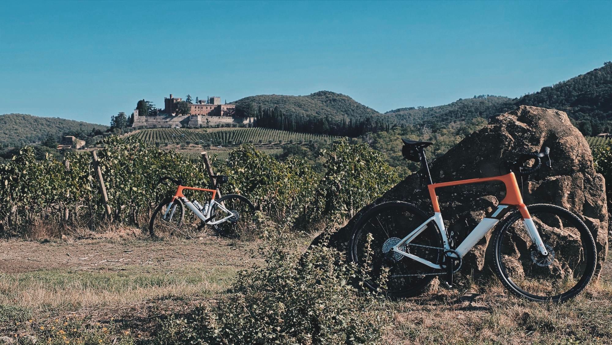
Morning in Gaiole in Chianti tastes of damp earth, night chill trapped in the shadows of ancient stone palazzi, and the scent of vine shoots drying under the early sun. Suspended in the air is that distinctive, chalky dust that means just one thing to any cyclist: the legendary strade bianche. Gaiole is no ordinary Tuscan hamlet. It is a cycling sanctuary, the annual launchpad for thousands of riders astride vintage steel steeds from a bygone era. My objective was the Percorso Corto Gallo Nero – an official 82-kilometer segment of the mythical L'Eroica route that unveils the rawest, wilder side of Chianti Classico. Swapping wool jerseys and leather lace-ups for a modern, razor-sharp 3T Racemax Rival gravel machine, this ride set up a direct, uncompromising dialogue between contemporary engineering and historical white gravel paths.
| Metric | Data |
| Distance | 82.5 km |
| Elevation | +1602 m |
| Riding Time (moving) | 5h 23min |
| Bike on the Route | gravel 3T RACEMAX RIVAL |
| Highest Point / Viewpoint | 767 m a.s.l. (km 64.7) |
| Crux Climb | 4 km (+212 m, max 12%) |
| Route Character | Physically demanding adventure / Fast-rolling gravel & tranquil back roads |
Towards the Trail: Gaiole’s Morning Chill and the First White Ribbons of Gravel
The roll-out south from Gaiole in Chianti wastes no time with gentle warm-ups. The moment your wheels leave the cobblestones of the village, pavement gives way to a pale limestone track that crunches emphatically under tread. The sun barely grazes the hilltops while the valleys remain submerged in ribbons of morning fog. The air is crystalline, carrying the earthy fragrance of warming pine needles and towering cypresses that stand like sentinels flanking the route.
The initial fifteen kilometers are a lesson in cadence and body positioning. The 3T Racemax slices across the hard-packed gravel with absolute poise, smoothing out the high-frequency vibrations of Tuscan washboard sectors. The road immediately lays down the law: there is no steady, rhythmic cruising here. The rolling terrain undulates relentlessly, demanding active weight shifts in and out of the saddle. Every bend reveals another estate where terraced rows of Sangiovese vines tumble steeply toward valley floors, etching geometric lines across the hillsides.
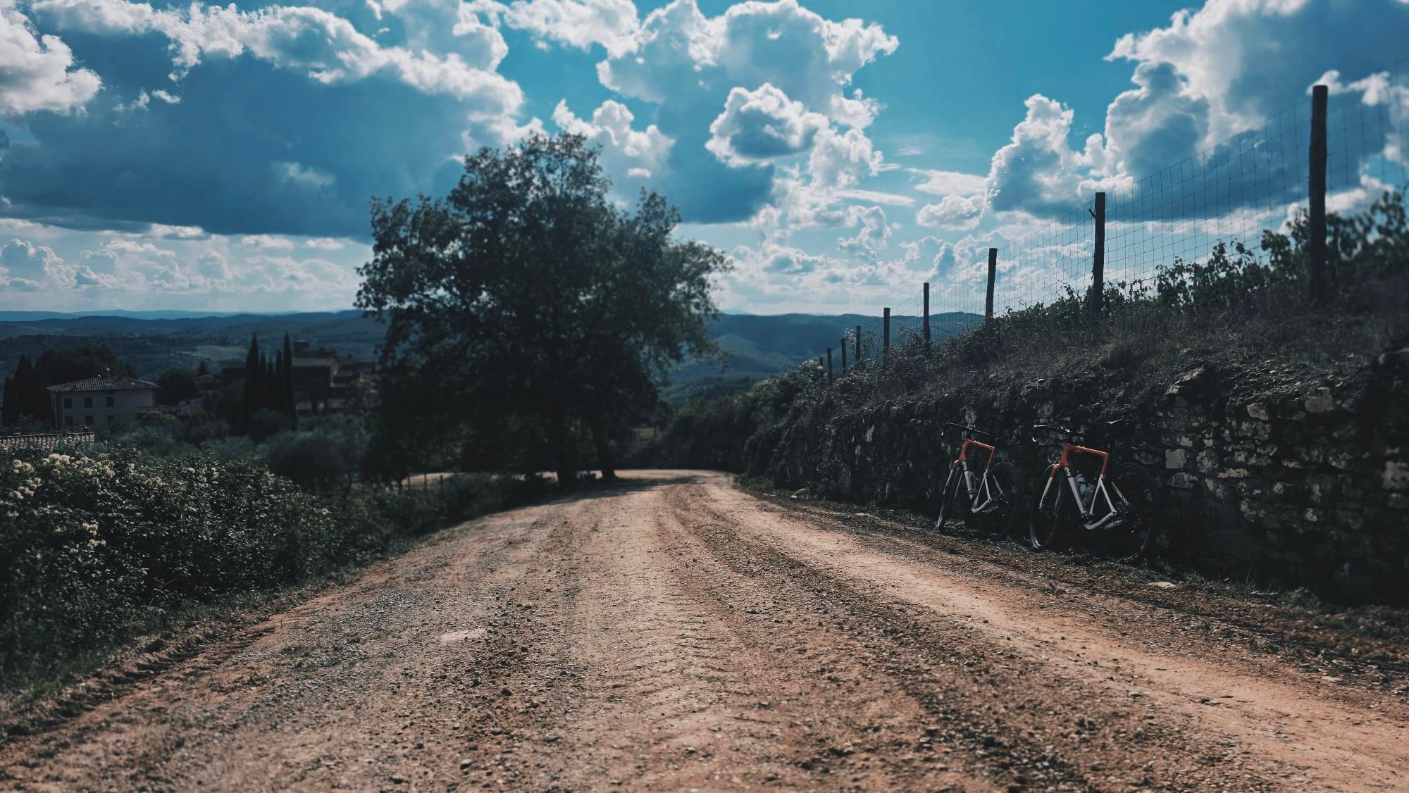
Near kilometer 20, the route approaches Castelnuovo Berardenga – the southern outpost of the Chianti territory. Here the landscape softens briefly, and the horizon opens out toward the undulating clay hills of the Crete Senesi shimmering to the south. The gravel momentarily gives way to smooth, sweeping secondary tarmac: a welcome chance to draw breath, hydrate with electrolytes, and prep mentally for the substantive climbing looming ahead.
Southern Vineyards and Medieval Bastions: Through the Heart of Chianti towards Radda
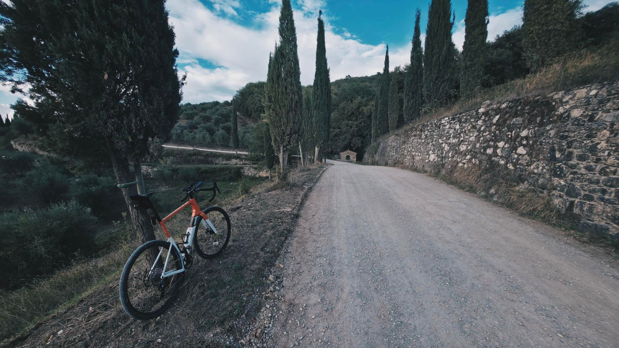
Past the agricultural plateau around kilometer 20, the first true test of climbing power arrives: a four-kilometer crux climb gaining more than two hundred meters of elevation, spiked with stiff gradients ramping up to 12%. The gravel on this ascent is dry and loose, scattered with sharp limestone chips. Here, subtle center-of-gravity balance is paramount: pulling too aggressively on the hoods spins the rear tire on loose marbles, while tucking too far forward unweights the rear axle and loses traction. The Racemax reveals its aggressive race DNA: its stiff bottom bracket and rear triangle channel every watt directly into forward momentum, clawing upward meter by meter.
Timeless stone farmsteads shaded by centuries-old holm oaks feel entirely detached from the modern world. There are no cars, no industrial hum – just measured breathing, the rattle of stones ricocheting off down tubes, and the shrill drone of cicadas. The road winds through olive groves whose silver-green leaves shimmer in the breeze, before a sequence of fast, technical descents ushers the ride into the outskirts of Radda in Chianti at kilometer 41.
Radda rises from its hilltop like an impregnable fortress. Its medieval ramparts and the prominent Palazzo del Podestà evoke the historical strength of the Chianti League, whose enduring emblem is the proud Black Rooster – the Gallo Nero. The town bustles with understated charm. Shaded stone passages waft aromas of fresh espresso and baked Tuscan bread, but our GPX file brooks no café lingering today. Non-stop riding demands discipline: a brief glance at the weathered stone facades, an energy bar unwrapped on the roll, and the wheels are already humming downhill toward cool river bottoms to begin the assault on the day's high country.
Climbing into the Clouds: The 767 m Peak and Endless Monti del Chianti Ridges
The second half of the loop reveals a very different Tuscan personality. Manicured, postcard-ready vineyards fade away, replaced by dense, wild forests of sweet chestnut and oak cloaking the ridges of the Monti del Chianti. From kilometer 55, the trajectory points steadily upward. The asphalt turns coarse, cracked by stubborn roots, before surrendering once again to rugged forest gravel. This section skirts legendary Lamole – a village clinging to steep terraces, renowned for some of the highest-elevation vineyards in the entire region.
During the official L'Eroica festival, Lamole hosts the famous rest stop where riders savor steaming bowls of ribollita, cured meats, and local wine served by locals in heritage dress. Riding it solo and self-supported, however, the silence is total. Grinding up switchbacks far from festival crowds, the historic gravity of these roads becomes palpable. You rely entirely on back-pocket nutrition and whatever is left in your bottles.
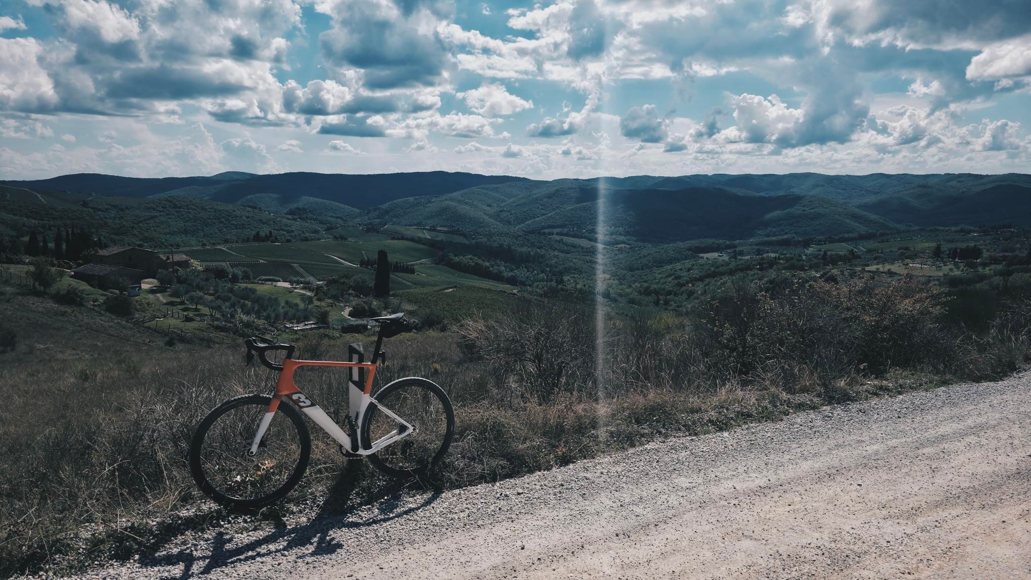
The culmination arrives at kilometer 64.7: the GPS computer ticks up to precisely 767 meters above sea level, marking the highest elevation of the day. A cathedral-like hush envelops the ridge, broken only by wind soughing through pine boughs. Gaps in the tree canopy frame sweeping panoramic vistas: the rippling valley of Greve in Chianti stretches to the west, backed by the hazy blue silhouette of the Apennines. Here, climbing fatigue evaporates into sheer scale. It is worth pausing briefly, leaning a dust-coated frame against a tree trunk, and soaking in the raw horizon before letting gravity take over.
Forest Descents and the Return Surge to Gaiole
The descent off the summit ridge (from km 64.7 to km 70.3) demands 5.4 kilometers of absolute concentration. You shed over four hundred vertical meters down tight, stone-strewn hairpins. Speed ramps up instantaneously, and the Racemax tracks with surgical precision. The tires bite into loose gravel, kicking up a white plume of dust in your wake. Every braking point ahead of a switchback requires a feather-light touch – Tuscan sterrato offers zero margin for error, as dry limestone dust rolls under tread like ball bearings.
Once clear of the dense woodland canopy, the landscape eases back into classic agricultural balance. The late-afternoon sun hangs lower, casting dramatic cypress shadows across the route. Warm, golden light bathes the stone walls of solitary rustici, and the air turns rich with the scent of wild mint, parched hay, and warm dust. Legs throb from conquering over 1,600 meters of climbing, but the gentle, undulating gravel flow of the final ten kilometers invites an effortless, hypnotic rhythm.
The final stretch toward Gaiole in Chianti brings the journey full circle. Sweeping gently down through the valley of the Massellone stream closes this iconic loop. Rolling back onto the cobblestones of Piazza Ricasoli after 5 hours and 23 minutes of non-stop effort, both rider and bike are cloaked in a thick layer of white chalk dust. It is the ultimate badge of honor – tangible proof of having conquered the rugged, unforgiving paths of the Gallo Nero.
Sightseeing Highlights: What to See On and Around the Route
- ↳ Castello di Brolio (south of Gaiole): A monumental fortress with a thousand years of history, ancestral home of the Ricasoli family. It was here in the 19th century that Baron Bettino Ricasoli formulated the original Chianti Classico wine recipe. Sweeping ramparts overlook south Tuscan hills and extensive estate vineyards. Located just a short detour off the route, it makes for a worthwhile historical excursion.
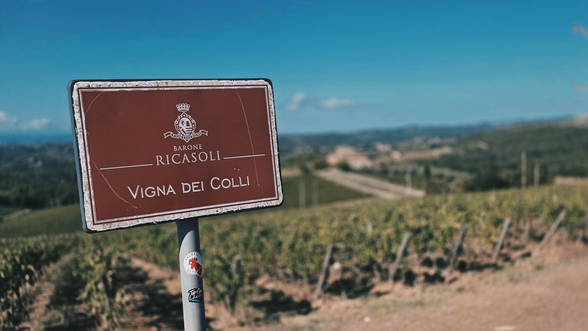
- ↳ Piazza Ricasoli and the L’Eroica Monument in Gaiole in Chianti: The official start and finish point. A narrow, elongated square framed by sandstone houses where the spirit of vintage cycling beats year-round. A steel monument honoring L'Eroica cyclists stands on the edge of the square – the mandatory photo backdrop with your dust-caked bike.
- ↳ Medieval Center of Radda in Chianti: The ancient administrative hub of the Chianti League preserves its intact 14th-century defensive perimeter. Ease your pace down cobblestoned Via Roma to admire the coats of arms carved into Palazzo del Podestà and explore the arched walkways (camminamento) that provide welcome shade on sweltering days.
- ↳ Terraced Vineyards of Lamole: An exceptional hill hamlet perched on the slopes of Monte San Michele. Its vines grow on ancient dry-stone terraces (muretti a secco), soaking up radiant heat from the rocks to ripen fruit at elevations above 500–600 meters. The vantage point looking out from the narrow approach road over the valley amphitheater is one of the most stunning in all of Italy.
Practical Guide: Cafés, Water, and Trail Tips
- ↳ Coffee Stops & Local Flavors: This 82.5 km route was completed in continuous athletic mode without café sit-downs – relying on bars, gels, and electrolytes taken on the fly. For riders taking a touring approach, Gaiole in Chianti offers excellent post-ride dining. Piazza Ricasoli hosts traditional spots (like Bar Lo Sfizio or Ristoro di Vinca) ideal for unwinding with a board of aged Tuscan pecorino, local salumi, and a restorative bowl of hearty ribollita soup.
- ↳ Water Points and Rest Areas: Relentless sun and chalky sterrato dust dry the throat quickly. Fortunately, reliable public drinking fountains (fontanelle) dot the route. Fresh, potable water is readily accessible in the town squares of Gaiole, Castelnuovo Berardenga, and central Radda in Chianti. Scenic stone benches shaded by cypresses can be found near the town walls in Radda and on forest clearings near the ridge crossing below Monte San Michele.
- ↳ Bike and Tire Recommendations: A versatile gravel bike with generous gearing range is best suited to comfortably spin up 12% ramps. Run 38–42 mm tires: a fast-rolling center strip paired with shoulder knobs strikes the optimal balance between asphalt efficiency and loose gravel cornering grip. Standard narrow road tires are strongly discouraged due to sharp limestone puncture risks, as are heavy trekking bikes on steep grades.
- ↳ Navigation and GPX Files: The Percorso Corto Gallo Nero features partial permanent signage with brown L'Eroica markers displaying a cyclist icon. However, multiple unmarked forest forks make wrong turns easy. Load the official GPX track onto your bike computer or smartphone navigation app to maintain momentum without navigational guesswork.
Frequently Asked Questions (FAQ)
Everything you need to know before hitting this route
How long does it take to cycle the Gallo Nero route?
▾
What are the most notable viewpoints and landmarks along the route?
▾
Which bicycle and tire setup are best suited for this route?
▾
Are there reliable water refill points along the way?
▾
Free Bike Coloring Pages A4 for Kids & Family
65 vector coloring sheets ready to print (300 DPI, no login required). Gravel, Full MTB, E-Bike & XC!