Vistula Delta Gravel Loop: Gdańsk, Sobieszewo Island, and the Endless Żuławy Polders
✨ Key Route Information (Quick Facts)
GPX Route for Garmin, Wahoo, Komoot, and Other Bike Computers
Download the free GPX track of this cycling route. The file can be used on Garmin Edge, Wahoo ELEMNT, Hammerhead Karoo, Bryton Rider bike computers and Komoot, OsmAnd, or Ride with GPS apps.
- 1. Vistula Delta Gravel Loop: Gdańsk, Sobieszewo Island, and the Endless Żuławy Polders
- 2. Route & Hardware Telemetry
- 3. Toward the Estuary: Morning Cadence along the Dead Vistula
- 4. The Endless Polders: Echoes of Mennonites and Big Waters
- 5. Returning to the River: The 1895 Vistula Cut
- 6. Back to the Moraine: The Final Punchy Climb
- 7. Sightseeing Highlights along the Trail
- 8. Practical Guide: Coffee Stops, Resupply & Bike Setup
▶ Route Video & YouTube Vlog
Nakręcone Rowerem — YouTube
YouTube HD@nakrecone-rowerem • Cycling, Gravel & Mountains
Route Reels / YouTube Shorts
YouTube Shorts & Video
Route Reels / YouTube Shorts (1):
Wyspa Sobieszewska i wał Wiślany z drona #gravel #specialized #gravelbike #diverge #dji #djiflip

Interactive GPS Map
Precise GPX track route with waypoints
Terrain & Surface Breakdown
Surface details, terrain breakdown, and gear tips
🏆 Route Highlights & Scenic Spots:
- ✓ Traversing Sobieszewo Island alongside the Mewia Łacha and Ptasi Raj nature reserves
- ✓ Floodbank gravel crests following the mighty Vistula Cut (Przekop Wisły)
- ✓ Historic timber-framed church in Kiezmark
- ✓ Atmospheric 14th-century Gothic church ruins in Steblewo
- ✓ Przegalina Lock separating the Dead Vistula from the main river flow
🛣️ Terrain & Surface Breakdown
Mostly flat terrain across the Vistula Delta depression and polders, framed by rolling moraine hills at the start and finish in Gdańsk. Surfaces include quiet rural tarmac, compacted gravel atop river floodbanks, concrete slab farm lanes, and sandy pine forest doubletracks.
🚴 Recommended Bike & Gear
A gravel bike or light cross bike equipped with 38 to 45 mm tubeless tires is ideal, smoothing out rough delta concrete slabs and deep pine needle tracks. Pack a windproof gilet to fend off stiff Baltic headwinds over open polders.
📍 Location — Poland
Gdańsk, Pomerania, Poland (PL) — 111.1 km, +178m.
Vistula Delta Gravel Loop: Gdańsk, Sobieszewo Island, and the Endless Żuławy Polders
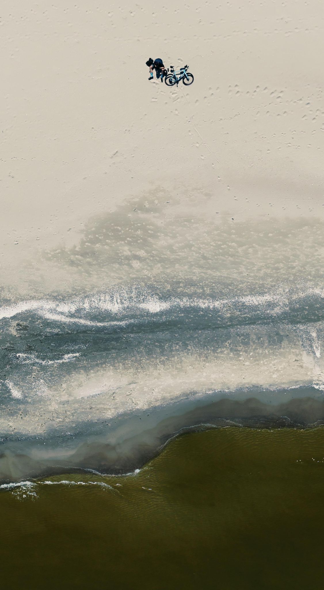
Morning air in Gdańsk carries a sharp, crisp maritime bite mingled with the moist humus of the Tricity Landscape Park moraine ravines. Rolling down from the glacial plateau, you immediately feel the momentum of the descent toward table-flat coastal plains. The goal of this ride was not chasing vertical climbing records, but immersing into sprawling horizons where water and centuries of human drainage work collide. Ahead lay more than a hundred kilometers of gravel tracks crossing Sobieszewo Island, hugging the engineered floodbanks of the Vistula Cut (Przekop Wisły), and delving into the silent, wind-sculpted farming hamlets of Żuławy Gdańskie.
| Metric | Value |
| Distance | 111.1 km |
| Elevation | +178 m |
| Moving Time (Net) | ~5h 11m |
| Bike Setup | Gravel rig with 40 mm semi-slick tubeless tires |
| Highest Elevation Point | +178 m |
| Crux Climb | 2.8 km (+94 m, max 8%) |
| Route Character | Endurance gravel ride / Fast levee gravel and tranquil backroads |
Toward the Estuary: Morning Cadence along the Dead Vistula
Departing from the Gdańsk moraine district, an initial brisk descent led across the city's western corridor, pausing briefly on Franciszka Rakoczego Street for a hydration check and luggage cinch. Leaving behind urban traffic and harbor dockyards, the landscape relaxed into silent marshlands. The track alongside the Dead Vistula (Martwa Wisła) unfolded wide reed beds and the unmistakable smell of estuarine silt, signaling maritime proximity.
Crossing the Sobieszewo drawbridge transported the ride into pine-scented serenity. Fast-rolling gravel paths weaved through coastal pine woods where the bike hummed over packed pine needles. A short detour at Beach Access 19 brought the roar of Baltic surf and cool sea breeze behind the dune ridge.
Heading toward the eastern tip of the island delivers pure gravel bliss: quiet back alleys merge into forest tracks serenaded by circling gulls and whistling treetops. Reaching Przegalina and the old lock compound on Przegalińska Street highlighted the magnitude of regional water management, isolating the old river arms from the surging main Vistula channel.
The Endless Polders: Echoes of Mennonites and Big Waters
Crossing over onto the massive river dyke toward Kiezmark introduces staggering scale. The pancake-flat horizon stretches endlessly, accented only by solitary willow copses, rows of poplars, and historic Mennonite arcade homesteads. Brief stops in Kiezmark—first near the S7 expressway bridge and then along Wałowa Street—opened magnificent panoramic vistas over Poland's royal river.
Turning deep into the depression plains through Giemlice toward Steblewo became a masterclass in reading headwinds. Though GPS elevation dipped below sea level, steady polder winds acted like an invisible gradient. In Steblewo, the haunting brick skeleton of the ruined 14th-century Gothic church rises directly from open fields—a solemn monument to the turbulent history of the lowlands.
Looping back toward the river alongside drainage canals mirroring steely skies, the gravel bike demonstrated its true versatility: gliding effortlessly across weathered asphalt, packed levee gravel, and the occasional concrete jumbo slabs.
Returning to the River: The 1895 Vistula Cut
At Kwiatowa Street in Kiezmark, a historic memorial marks the inauguration of the Vistula Cut on March 31, 1895. Standing atop the massive flood dyke, it is impossible not to admire the engineering triumph that tamed river ice floes and shielded Gdańsk from catastrophic inundations. Below, the immense volume of water surges directly into Gdańsk Bay.
The course traced northward toward Świbno, weaving around Urwista and Akwenowa streets. Pausing by Świbnieńska Street, the scent of fresh smoked fish and docked fishing trawlers evoked traditional maritime heritage. Passing Wiślinka on Sobieszewska Street completed the lowland chapter, with 90 km already registered in the legs under lengthening afternoon shadows.
Back to the Moraine: The Final Punchy Climb
The closing chapter delivers an abrupt topographical twist. After tens of kilometers spinning below sea level, re-entering Gdańsk demands conquering the glacial moraine wall. The sustained ramp between kilometer 105.7 and 110.3—gaining nearly 100 meters at grades reaching 8%—delivers a stinging punch to tired legs.
Reaching the route summit at 81 m above sea level yielded pure gravel satisfaction. Looking back from the hilltop ridge over the vast, shimmering delta plains traversed hours earlier provided breathtaking closure before diving back into the sheltered moraine forests.
Sightseeing Highlights along the Trail
- Przegalina Hydrotechnical Lock: A late 19th-century masterwork regulating water flow between the cut and the historical riverbed. Take a few minutes to inspect the vintage brick lock chamber beside the modern shipping weir.
- St. Leszek Church in Kiezmark: A historic half-timbered church showcasing distinctive regional architectural heritage and sacred folk art.
- Gothic Church Ruins in Steblewo: The solemn red-brick ruins of the 14th-century Church of Saints Peter and Paul, burned down in 1945, set amid a peaceful countryside graveyard.
Practical Guide: Coffee Stops, Resupply & Bike Setup
- Espresso Stop & Fuel: Franciszka Rakoczego (km 1.1, 9 min pause). An ideal early launch pad for morning caffeine and pastries before heading out into the open delta.
- Water Points & Shelters: Stock up on bidon refills at local convenience stores in Sobieszewo, Kiezmark, or Świbno. Weather shelters atop river levees and beach access pavilions offer superb rest points.
- Bike & Tires: Gravel or endurance touring bikes running 38–42 mm tubeless tires. Supple tire casings are essential to tame jarring concrete slab joints and rough gravel levees.
- Navigation: The track navigates public roads, floodbank crests, and unpaved forest paths; loading the GPX track onto a dedicated head unit is highly recommended.
Frequently Asked Questions (FAQ)
Everything you need to know before hitting this route
How long does it take to ride this 111 km gravel loop?
▾
What are the key sightseeing highlights along the route?
▾
What type of bike and tire setup is recommended?
▾
Free Bike Coloring Pages A4 for Kids & Family
65 vector coloring sheets ready to print (300 DPI, no login required). Gravel, Full MTB, E-Bike & XC!