Gravel Kashubian Switzerland: Loop from Stężyca via Kartuzy and Chmielno
✨ Key Route Information (Quick Facts)
GPX Route for Garmin, Wahoo, Komoot, and Other Bike Computers
Download the free GPX track of this cycling route. The file can be used on Garmin Edge, Wahoo ELEMNT, Hammerhead Karoo, Bryton Rider bike computers and Komoot, OsmAnd, or Ride with GPS apps.
- 1. Gravel Kashubian Switzerland: Loop from Stężyca via Kartuzy and Chmielno
- 2. Route & Gear at a Glance
- 3. Toward the Radunia Ribbon: Departure and Forest Tracks
- 4. The Heart of Kashubia: Monastic Peace in Kartuzy and Łapalice Castle
- 5. The Blue Ribbons of Chmielno and Return to Lake Raduńskie
- 6. Cultural & Scenic Highlights
- 7. Practical Guide: Cafés, Water, and Logistics
▶ Route Video & YouTube Vlog
Nakręcone Rowerem — YouTube
YouTube HD@nakrecone-rowerem • Cycling, Gravel & Mountains
Kaszubski klasyk: Zamek Łapalice, Kartuzy i Kamienne Kręgi na gravelu
Interactive GPS Map
Precise GPX track route with waypoints
Terrain & Surface Breakdown
Surface details, terrain breakdown, and gear tips
🏆 Route Highlights & Scenic Spots:
- ✓ The Radunia River Gorge and glacial Raduńskie Lakes
- ✓ Mysterious unfinished concrete shell of Łapalice Castle
- ✓ Collegiate Church of the Assumption in Kartuzy with its coffin-shaped roof
- ✓ Panoramic moraine ridges around Chmielno and Koszowatka
🛣️ Terrain & Surface Breakdown
Highly varied surfaces: smooth asphalt stretches alternate with packed forest gravel, dirt trails, and occasional sandy segments through the Mirachowo woods. Rolling terrain with sharp moraine kickers featuring gradients easily exceeding 10-15%.
🚴 Recommended Bike & Gear
A gravel bike or lightweight cross/XC hardtail fitted with tires at least 40-45 mm wide is optimal. Tubeless tires with versatile tread (such as Pirelli Cinturato Gravel M) offer confident grip on loose stones and forest pine needles, while wide-range gearing ensures smooth cadence on punchy Kashubian ramps.
📍 Location — Poland
Municipality of Stężyca, Pomerania, Poland (PL) — 69.7 km, +823m.
Gravel Kashubian Switzerland: Loop from Stężyca via Kartuzy and Chmielno
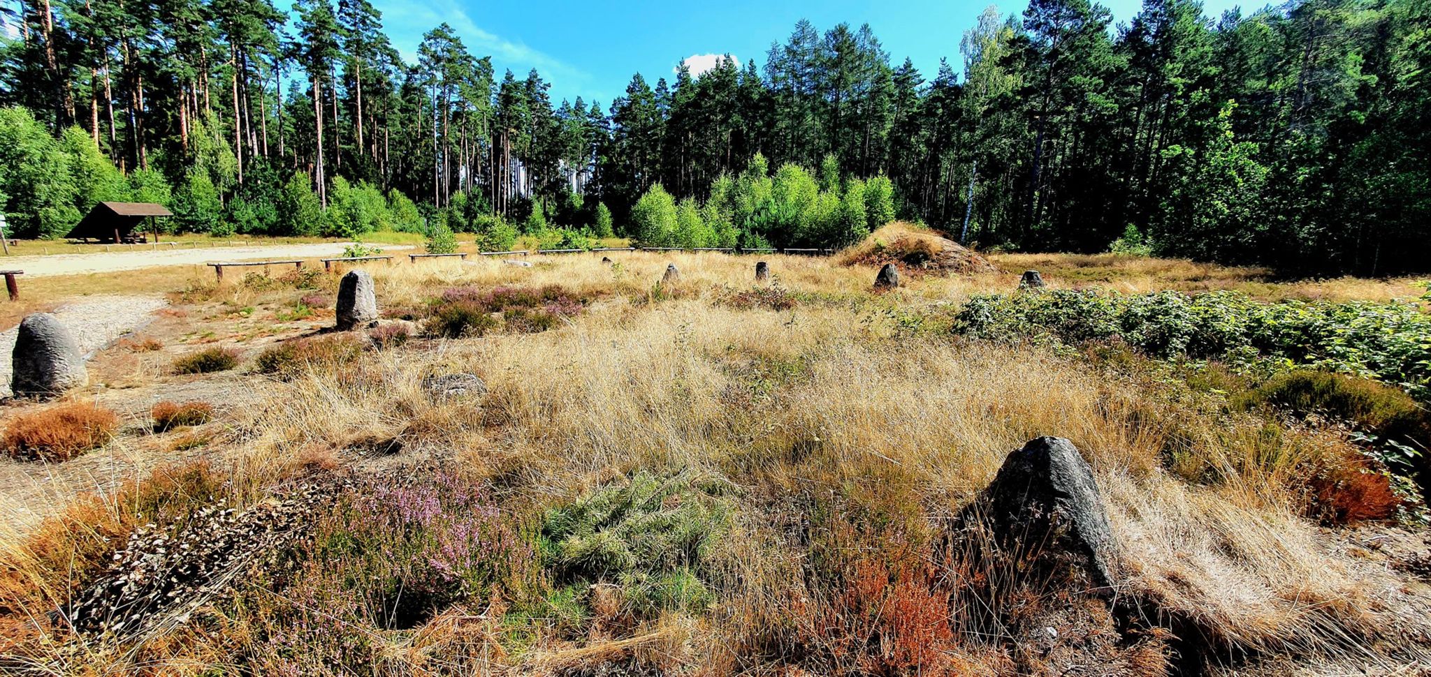
The morning air above Lake Raduńskie Górne smells of damp calamus and crisp chill, which steadily dissolves under the rays of the rising sun. Stężyca wakes up in no rush. Before holiday traffic kicks in, I roll out toward the rolling horizons of Kashubian Switzerland in Poland. This landscape never turns monotonous—ancient glaciers carved a relief reminiscent of alpine foothills, where every turn reveals a sapphire lake or the steep wall of a dense beech forest. Ahead lie nearly seventy kilometers of pure gravel adventure aboard a Rose Backroad AL GRX 400.
| Metric | Details |
| Distance | 69.7 km |
| Elevation | +823 m |
| Net Riding Time | 4h 06min |
| Bike | Rose Backroad AL GRX 400 (2020) |
| Highest Elevation / Crest | +823 m |
| Crux Climb | 1 km (+52m, max 15%) |
| Route Character | Scenic touring & adventure / Fast gravel flow & calm backroads |
Toward the Radunia Ribbon: Departure and Forest Tracks
The opening kilometers from Stężyca lead gently toward Pierszczewko. Morning dew still glistens on grassy meadows, while 45 mm Pirelli Cinturato Gravel M tires roll smoothly across damp, compact gravel. The first short pause arrives at km 4.7—the Pierszczewko rest point offers a moment of serenity overlooking the lake surface and rustling reed beds. Shortly after, I pass Krzeszną, crossing the railway line near platform 2, where the scent of sun-warmed railway sleepers blends with fragrant pine.
The terrain quickly sheds its flat demeanor. The road begins to roll relentlessly, and around the ninth kilometer near Kolańska Huta by the Na Koszowatkę viewpoint, the biting moraine character of the region shows its teeth. These short climbs may not be long Alpine passes, but their punchy ramps demand serious wattage. The stiff aluminum Rose Backroad with its carbon fork responds promptly to hard efforts out of the saddle, while the Shimano GRX RX400 hydraulic disc brakes deliver absolute composure on twisting gravel descents plunging toward the Radunia valley.
Traversing Sławki along Kamienna Street and entering Somonino, the landscape broadens into wide, rolling meadows. The sun climbs higher, carrying the aroma of freshly cut grass. A quick stop by the Sarni Dwór forestry station allows for a breather before plunging into the next dense woodland sector. The fast gravel around Wyczechowo, intersecting fire trail 16, epitomizes true gravel freedom—hard-packed tracks with mature tree crowns filtering sunlight into golden patterns along the path.
The Heart of Kashubia: Monastic Peace in Kartuzy and Łapalice Castle
Passing Leszno along Starowiejska Street, the loop aims straight toward the cultural capital of the region—Kartuzy. Entering the town, riders are greeted by the unmistakable silhouette of the 14th-century Carthusian Collegiate Church, topped with a roof shaped like a coffin lid—a poignant memento mori symbol of the order. Escaping the main streets, I stop by the town square near km 33.6, close to the Dbam o Zdrowie stop. It is the perfect opportunity to refill bidons, grab a snack, and admire the renovated regional architecture of this town tucked between four pristine lakes.
From Kartuzy, the route climbs up toward Łapalice, where the woodlands grow denser and the topography more rugged. It is here, right around the fortieth kilometer, that the track reaches its highest point at 235 m above sea level. From a quiet forest detour emerge the concrete towers of the famous unfinished Łapalice Castle. This monumental, contemporary ruin begun in the 1980s cuts a surreal profile among quiet beech woods. Nearby stands the charming wooden Forestry Chapel of Stanisław Szeszula on Podgórna Street, inviting a quiet pause in the deep silence of the forest.
Rough gravel and quick descents take their toll, however—a rear spoke on my Rose R Thirty Disc snapped cleanly with a sharp ping. The wheel had a slight wobble, but generous frame clearance allowed me to nurse the bike forward without tire rub against the stays. A stark reminder that Kashubian trails test both rider and gear.
The Blue Ribbons of Chmielno and Return to Lake Raduńskie
Leaving Łapalice, the route swoops down toward Chmielno—one of the most scenic villages in Poland, squeezed tightly along a narrow isthmus between Lake Białe and Lake Kłodno. I stop along Świętopełka Street at km 51.3. This is the historic cradle of Kashubian pottery and the Necel family workshop. Sitting on a lakeside bench, I watch sailing dinghies skim across calm waters, accompanied only by the cry of gulls and the gentle slap of waves.
The final leg traces the Radunia Circle waterway route through Przewóz, crossing a picturesque bridge over the river along Raduńska Street. Warm late-afternoon sunlight casts elongated shadows over rural dirt roads. The remaining kilometers provide a gentle spin back to the staging point in Stężyca. The computer stops at nearly 70 kilometers with over 800 meters of climbing. Burning legs give way to deep satisfaction, the kind only a day spent wandering Kashubian gravel can deliver.
Cultural & Scenic Highlights
- ↳ Collegiate Church of the Assumption in Kartuzy: A unique Gothic gem featuring a coffin-lid roof. Take a short detour inside to admire cordovan leather wall hangings and masterfully carved Carthusian choir stalls.
- ↳ Łapalice Castle: Though officially an abandoned residential construction site from the late 20th century, this structure has gained legendary status. Twelve towers symbolizing the apostles and soaring vaults hidden in the forest create an astonishing architectural curiosity.
- ↳ Chmielno & Ceramic Heritage: A lakeside village famous for the Necel Kashubian Ceramics Museum, where clay pottery traditions and distinct regional motifs have been preserved for generations.
- ↳ Upper Radunia Valley & Raduńskie Lakes: A ribbon lake network linked by the Radunia River, forming an iconic water route. Viewed from the saddle, the steep beech-covered shorelines and scenic ridge vistas are breathtaking.
Practical Guide: Cafés, Water, and Logistics
- ↳ Coffee Stops & Local Bites: A peaceful early spot for contemplation is the Pierszczewko rest stop at km 4.7. For a proper mid-ride espresso stop and hearty bakery snacks, plan a break at Kartuzy market square (km 33.6) or right along the lakefront in Chmielno along Świętopełka Street (km 51.3).
- ↳ Water Points & Trail Shelters: Grocery stores for refilling supplies are readily available in Somonino, Kartuzy, and Chmielno. State Forestry wooden shelters can be found at trailheads near Wyczechowo and Łapalice.
- ↳ Recommended Bike and Tires: A gravel bike or lightweight hardtail MTB is ideal. Tires between 42 mm and 47 mm with semi-knobby tread provide optimal vibration damping on roots and traction over sandy patches.
- ↳ Navigation: Dense forest networks around the lakes can cause GPS signals or mobile data to drop. Always download the GPX track to your dedicated cycling computer before starting.
Frequently Asked Questions (FAQ)
Everything you need to know before hitting this route
How long does this gravel route take to complete?
▾
What are the key scenic spots along the way?
▾
Which bike setup and tires work best on this loop?
▾
Free Bike Coloring Pages A4 for Kids & Family
65 vector coloring sheets ready to print (300 DPI, no login required). Gravel, Full MTB, E-Bike & XC!