Gravel Rollercoaster Through Kashubian Switzerland — 73 km of Gravel Action and 25% Climbs from Chmielno
✨ Key Route Information (Quick Facts)
GPX Route for Garmin, Wahoo, Komoot, and Other Bike Computers
Download the free GPX track of this cycling route. The file can be used on Garmin Edge, Wahoo ELEMNT, Hammerhead Karoo, Bryton Rider bike computers and Komoot, OsmAnd, or Ride with GPS apps.
- 1. Gravel Rollercoaster Through Kashubian Switzerland — 73 km of Gravel Action and 25% Climbs from Chmielno
- 2. Route at a Glance
- 3. Ride Story — Kilometer by Kilometer
- 4. Stage I: Start from Chmielno and Transfer to the Kashubian Capital (km 0 – 29.6)
- 5. Stage II: The Crux Climb — The Kashubian Test of Character (km 29.6 – 32.4)
- 6. Stage III: Halfway Point in Somonino and High-Speed Descent (km 32.4 – 52.4)
- 7. Stage IV: The Lake Raduńskie Finale and Return to Chmielno (km 52.4 – 72.9)
- 8. Nature, Sights, and Scenery Along the Way
- 9. Telemetry & Ride Data Analysis
- 10. Coffee & Refuel Spots
- 11. Gear Setup and Practical Tips
- 12. Summary & Free GPX Track
▶ Route Video & YouTube Vlog
Nakręcone Rowerem — YouTube
YouTube HD@nakrecone-rowerem • Cycling, Gravel & Mountains
Czy to NAJLEPSZY wyścig gravelowy w Polsce? 🚴♂️ Szuter Master Kaszuby
Interactive GPS Map
Precise GPX track route with waypoints
Terrain & Surface Breakdown
Surface details, terrain breakdown, and gear tips
🏆 Route Highlights & Scenic Spots:
- ✓ Raduńskie Circle (Kółko Raduńskie) glacial tunnel lakes
- ✓ Crux climb hitting a steep 25% gradient near km 30
- ✓ High-speed descent reaching 54.7 km/h into Somonino
- ✓ Highest elevation peak at 242 m above sea level near Kartuzy
- ✓ Scenic finish loop along Lake Raduńskie Dolne into Chmielno
🛣️ Terrain & Surface Breakdown
65% hardpack gravel and forest doubletrack, 20% smooth backroad asphalt, 15% technical forest singletrack with roots, loose gravel, and washboard sections. Rolling, highly punchy moraine terrain.
🚴 Recommended Bike & Gear
Gravel bike equipped with 40–45 mm tubeless tires set to 2.0–2.3 bar. Climbing gearing such as 1x12 (40T chainring with 10-44T/10-52T cassette) or sub-compact 2x11 is essential for 25% ramps.
📍 Location — Poland
Municipality of Chmielno, Pomerania, Poland (PL) — 72.9 km, +875m.
Gravel Rollercoaster Through Kashubian Switzerland — 73 km of Gravel Action and 25% Climbs from Chmielno
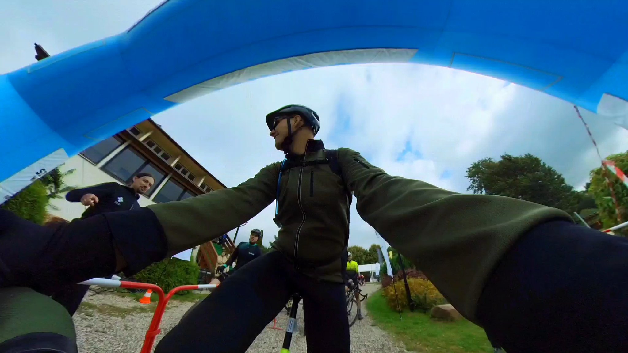
The morning sun gently cuts through the dense fog hanging over the surface of Lake Białe and Kłodno in Chmielno. The air is filled with crisp pine chill, while a double espresso is already coursing through the veins. The head unit locks onto GPS satellites, tires inflated to a dialed 2.3 bar hum quietly across damp dirt, and the pre-race briefing still echoes in the mind. Whoever thinks northern Poland is flat as a pancake clearly has never pointed a gravel bike into the beating heart of the Kashubian Landscape Park. A quick glance at the Garmin elevation profile dispels all illusions: 72.9 km and nearly 900 vertical meters of climbing over glacial moraine hills, laced with forest singletracks, deep gravel, and unforgiving punchy ramps. It's time to clip into SPD pedals, grab the drops, and hit the Szuter Master Kashubian Lake District route!
Route at a Glance
- Distance: 72.9 km
- Elevation Gain: +875 m / -963 m
- Moving Time: ~3h 34m
- Average Speed: 20.4 km/h (Max descent speed: 54.7 km/h)
- Highest Point: 242 m a.s.l. (km 11.8)
- Crux Climb: 1.3 km, +64 m climbing (avg. 4.9%, max steep wall 25% between km 29.6 – 32.4)
- Key Descent: km 38.1 – 38.8 (0.6 km, drop of -57 m, technical forest gully)
- Physical Difficulty: 3.5 / 5 (Continuous aerobic-anaerobic interval, short sharp punchy climbs)
- Technical Difficulty: 3 / 5 (Fast gravel flow, forest roots, washboard, dynamic descents)
- Recommended Gear: Gravel bike (40–45 mm tires with pronounced side knobs, tubeless setup)
---
Ride Story — Kilometer by Kilometer
Stage I: Start from Chmielno and Transfer to the Kashubian Capital (km 0 – 29.6)
We kick off in picturesque Chmielno (152 m a.s.l.), surrounded by the deep blue sheen of Kashubian lakes. The opening kilometers are pure gravel flow — hard-packed farm tracks and woodland fire roads running along a post-glacial trough. The legs quickly reach operating temperature as the terrain begins rolling immediately. By kilometer 11.8, we are grinding up into the dense forest tracts near Kartuzy, reaching the highest summit of the entire loop at 242 m a.s.l. Heart rate shoots straight into solid Zone 4, while fresh tubeless sealant handles the sharp trail stones without issue. Bypassing the outskirts of Kartuzy, we dive into wide, blistering gravel highways. Holding a steady 200–230 W on the flats saves vital watts for what lies waiting around the bend.
Stage II: The Crux Climb — The Kashubian Test of Character (km 29.6 – 32.4)
Just before kilometer 30, the easy rhythm ends. The moment of truth arrives: a 1.3 km climb averaging 4.9%, hiding a brutal forest gully ramp that ramps up to a ferocious 25% gradient! The chain drops instantly onto the biggest rear cog (a 40x42 bail-out gear saves the knees). Hovering over the saddle, weighting the front wheel prevents the bars from lifting off the loose gravel. Lungs are firing at max capacity, sweat drips onto the sunglasses, and the power meter reads an instant 380 W. Every pedal stroke is a fight for rear wheel traction. When we finally crest the ridge, the payoff is an explosive rush of endorphins and panoramic views over rolling moraine fields.
Stage III: Halfway Point in Somonino and High-Speed Descent (km 32.4 – 52.4)
Having conquered the crux climb, the track points toward Somonino (the midway mark at km 38.5, 151 m a.s.l.). Right after comes the most thrilling downhill of the day (km 38.1 – 38.8). In just 600 meters, we dump 57 meters of elevation. Hands deep in the drops, fingers hovering over hydraulic disc brakes, full focus ahead. Speed rapidly surges to 54.7 km/h as loose gravel sprays from the tires. Pure flow, carving tight forest bends, and enjoying every bit of the gravel bike's balanced geometry. From there, we fly onward toward Stężyca, tracing sparkling lake shores and taking in the hallmark beauty of the Kashubian Lake District.
Stage IV: The Lake Raduńskie Finale and Return to Chmielno (km 52.4 – 72.9)
The final 20 kilometers become a game of smart pacing and endurance. Between Stężyca and Chmielno (km 71.5, 133 m a.s.l.), the track hugs Lake Raduńskie Dolne. Over 700 meters of cumulative climbing already sit heavily in the legs, and every short 8% kicker bites hard into the calves. At kilometer 70, we hit the final fast gravel descent sweeping back toward the event village in Chmielno. We cross the line in 3h 34min with an average speed of 20.4 km/h. The result? 49th place out of 84 riders in the Men's Open category — mission accomplished with a massive grin!
---
Nature, Sights, and Scenery Along the Way
The route cuts through the crown jewels of the Kashubian Landscape Park:
- Raduńskie Circle (Kółko Raduńskie): A unique chain of 14 ribbon lakes formed by ancient glaciers, creating a breathtaking water-and-forest labyrinth.
- Chmielno: The heartland of Kashubian pottery and ceramics, boasting over a century of artisanal heritage from the Necl family workshop.
- Kartuzy Forests and Collegiate Church: Medieval heritage of the Carthusian Order framed by dense old-growth beech and oak woodlands.
- Kashubian Switzerland Viewpoints: Rolling moraine ridges reaching nearly 250 m a.s.l. that open onto vistas reminiscent of sub-Alpine foothills.
---
Telemetry & Ride Data Analysis
- Distance: 72.9 km
- Elevation Gain: +875 m / -963 m
- Maximum Speed: 54.7 km/h
- Average Speed: 20.4 km/h
- Estimated Calorie Burn: ~2,250 kcal
- Terrain Breakdown:
- Flat sectors: 29.9 km (gravel connectors and woodland doubletrack)
- Descents: 23.7 km
- Climbs and ramps: 19.3 km (including 5.5 km between 5–8.5% and steep pinches >12%)
- Training Takeaway: Highly punchy, interval-driven route. Demands efficient cadence control (85–95 rpm) on transfer sections and the ability to sustain short 350–400 W surges over steep gravel walls.
---
Coffee & Refuel Spots
1. Chmielno Cafés (Start/Finish): The ideal spot for a pre-ride espresso and post-race recovery meal (fresh local freshwater fish or traditional Kashubian crumb cake kuch).
2. Kartuzy (~km 16): Great food and coffee hub near the market square and monastery lakes, offering specialty coffee and fresh local baked goods.
3. Stężyca (~km 52): Marina and lakeside promenade lined with grocery stores and bistros — perfect for grabbing an energy bar, gel, and replenishing electrolyte bottles for the final 20 km push.
---
Gear Setup and Practical Tips
1. Tire Selection and Pressure: The sweet spot is a 40–45 mm gravel tire (e.g., Schwalbe G-One Bite, Tufo Thundero, or Panaracer GravelKing EXT). Recommended pressure for a 75 kg rider: 2.0–2.3 bar in a tubeless setup. Fresh sealant is mandatory for rocky forest trails.
2. Drivetrain and Gearing: A 1x12 setup (40T chainring with a 10-44T or 10-52T cassette) or 2x11 (46/30T with an 11-34T cassette) allows you to spin smoothly up 25% ramps without blowing up.
3. Hydration and Nutrition: Given the punchy interval profile, carry at least two 750 ml bidons with electrolytes and aim for 60–80 g of carbohydrates per hour (energy gels, bars, chews).
4. Navigation and Trail Safety: Forest paths can branch frequently; load the GPX track onto a dedicated head unit with offline routing. Watch for loose washboard braking bumps and rain-carved ruts on fast downhills.
---
Summary & Free GPX Track
The Szuter Master Kashubian Lake District loop from Chmielno delivers the very best of Polish gravel: technical woodland paths, lightning-fast gravel highways, mesmerizing lake panoramas, and punchy climbs that test your legs to the core.
Download the GPX track below, load it into your Garmin or Wahoo, and experience the pure gravel magic of Kashubian Switzerland firsthand! See you on the gravel!
Frequently Asked Questions (FAQ)
Everything you need to know before hitting this route
What is the best bike for the Szuter Master Kashubian Lake District route?
▾
How difficult are the climbs on this loop?
▾
Can the route be ridden year-round?
▾
Free Bike Coloring Pages A4 for Kids & Family
65 vector coloring sheets ready to print (300 DPI, no login required). Gravel, Full MTB, E-Bike & XC!